Drones City is preparing your view...
Drones City is preparing your view...
Enterprise-grade aerial intelligence for commercial real estate, active construction sites, land surveys, and infrastructure inspections. FAA Part 107 certified pilots. Nationwide coverage.

High-fidelity aerial imagery transforms how commercial properties are marketed. We capture every angle — from roof-level perspectives that reveal proximity to major highways, transit corridors, and regional landmarks, to wide-angle shots that put your asset in context with surrounding infrastructure.
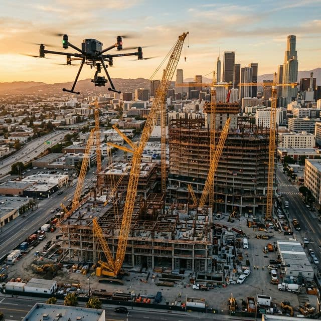
Keep owners, investors, and project teams aligned with scheduled aerial flyovers that document construction progress with precision. Our monthly photo and video updates combined with 3D site modeling give every stakeholder a clear, visual record of the build — and the data to back it up.

Our aerial survey and orthomosaic mapping services deliver high-accuracy geospatial data for land development, site analysis, and project planning. Using photogrammetry and advanced drone payloads, we produce centimeter-accurate maps, volumetric calculations, and survey-grade deliverables for professionals who need actionable data — not just pretty pictures.
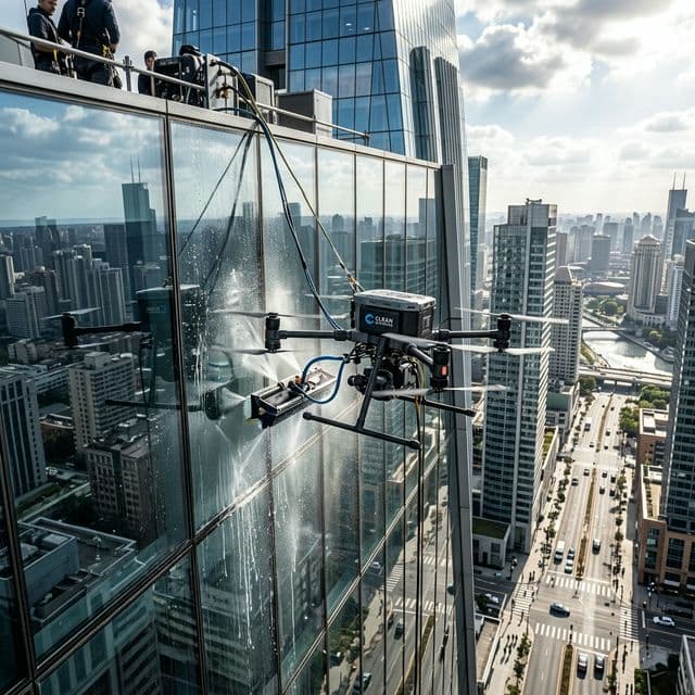
From commercial rooftops to cell towers, our drone inspection services eliminate the risk and cost of traditional high-access inspection methods. We deploy multi-sensor payloads — including thermal infrared and high-resolution visual cameras — to identify structural issues, moisture intrusion, thermal anomalies, and surface defects with unmatched detail.
Tell us about your project and we'll respond within 24 hours with a custom proposal.
Request a Free Quote →